Open Access Week 2015

Late post

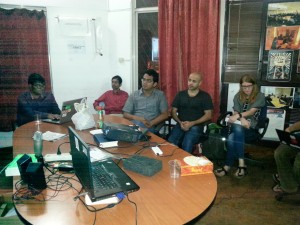
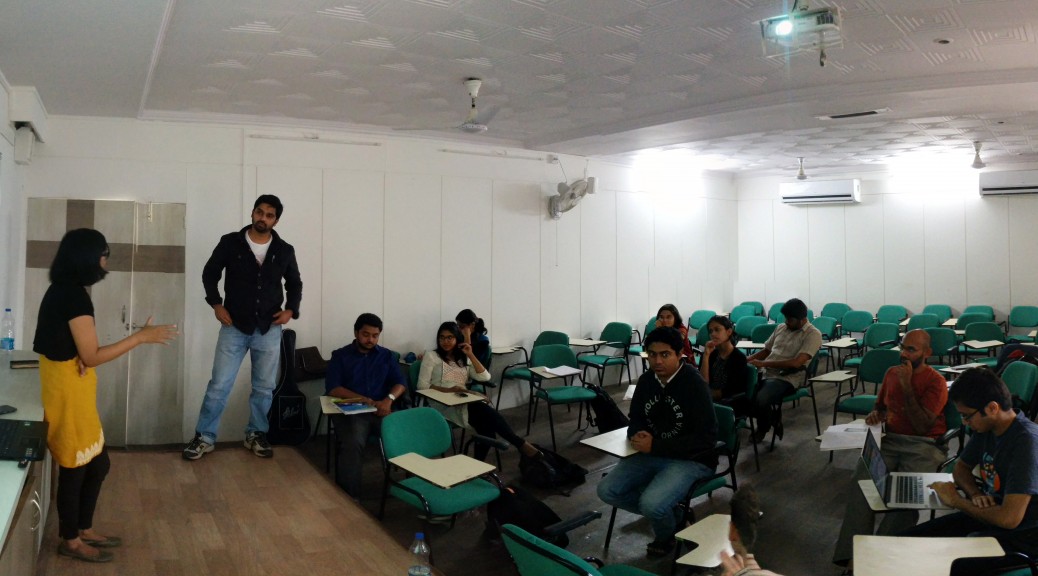
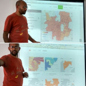
Open A20151024_190330ccess Week is used as an opportunity to spread awareness of open access issues throughout the world. It was Oct 24th to the 30th last year. Shravan and Mahroof from the Ahmedabad Chapter suggested we do the first every multi city hangout and bring together different groups working on openness issues throughout the country.

For the event we had a Google Hangout with:

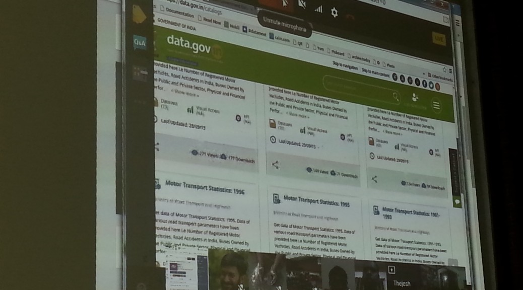
Data.Gov.In started us off with  Alka Misra and Sitansu participating from Delhi. They spoke about new features on Data.Gov.in, new datasets and visualizations available. They were also there to extend invites for more participation from the community.

Rahmanuddin from Access to Knowledge then spoke about Wikipedia and their community dedicated to local language knowledge sharing. They also had pertinent questions to Data.Gov.In regarding using open licenses. Since Wikipedia can’t use any data from Data.Gov.In since a license isn’t specified.

Ahmedabad Chapter went next. Ramya Bhatt, Assistant Municipal Commissioner from Ahmedabad, came and gave a brief talk about their plans for open data and smart cities. Alka from Data.Gov.In offered assistance. Then some students from Dhirubhai Ambani Institute of Information and Technology’s machine learning program used some data from Data.Gov.in to do analysis at the event. They looked at high budget allocation per state and drop out rates.

Open Access India’s Sridhar Gutam briefly went through the plans OAI has for the upcoming year to promote open access science and journals.

Hyderabad DataMeet is a new and yet to really take shape meet up but we were happy to see a first attempt. Sailendra took the lead as the organizer and brought together some people from IIM Hyderabad. Srinivas Kodali was there to talk about all the data he had made available that week.


20151024_184755Banalore DataMeet was there to share what has been going on with DataMeet and any new iniatives in Open Access


It was a great event, and as with all online events there were some technical difficulties but everyone was patient. It was awesome to see how the open culture space has grown, and to see so many new DataMeet chapters.

You can see the event below:

I hope we do one again soon minus the technical difficulties.

GPS and its Discontents

There is no greater success story for open data than GPS. The decision by the US government to make it available so it can be used for commercial purposes is the stuff of lore and what propels so much of the enthusiasm for open data.

Audiomatic’s show The Intersection is a podcast hosted by the dynamic duo Padmaparna Ghosh and Samanth Subramanian who explore interesting topics every other week.

Last week they did a show about GPS and it’s history and uses. Our own Thejesh GN was interviewed about his hobby of using GPS to go on treasure hunts.  They also talk about the Indian Government’s move to create a national GPS infrastructure with their own satellite so they don’t have to rely on the US.

I found the podcast informative and interesting and it hit on an important note as to why open data in India is so important.

Like GPS infrastructure to support India’s defense; data in India also needs to be invested in and promoted so that the reliance on others can reduce. Why is Google Maps, not Survey of India,  the source of mapping information in India? Why are their so many private data collection networks set up with foreign funds and private interests?Because GOI doesn’t invest in the potential of their data to build markets and make their job easier and more effective.

Open data is just one way of showcasing how better data can be used as well as offer guidance on how the government can invest in data collection and dissemination.

Anway it is a great podcast please give it a listen.

Analysing Bangalore’s Bus Network

Open Bangalore has been a pioneer in opening up several data sets that help understand Bangalore city. This includes the network of Bangalore Metropolitan Transport Corporation (BMTC). The BMTC operates over 2000 routes in the city and region of Bangalore and is the only real mode of public transit system in the city. Some of us at DataMeet took to time understand its network better by performing some basic analysis on the gathered dataset. The data set had bus stops, routes and trips. We inspected frequency, coverage, redundancy and reachability.

Longest route

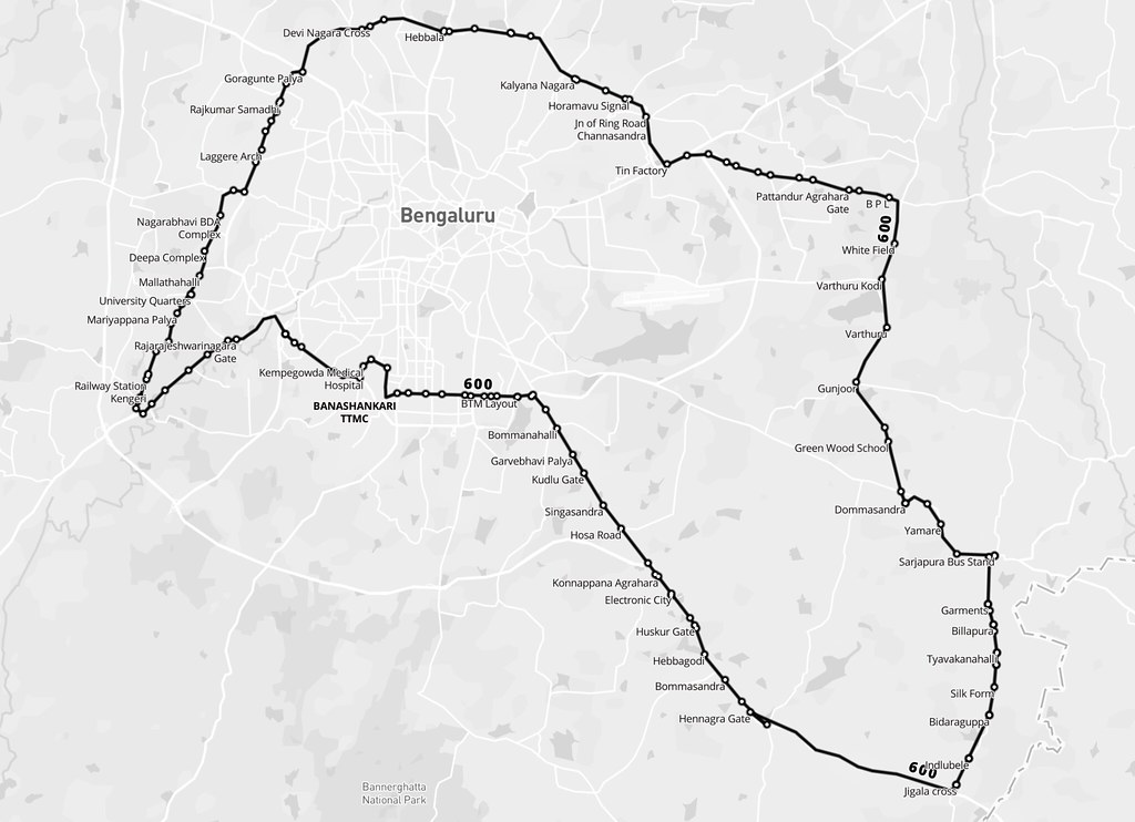
BMTC is known for its many long routes. Route 600 is the longest, making a roundtrip around the city, covering 117 km in about 5 hours. There are 5 trips a day, and these buses are packed throughout. It should be noted that while the route traces the edges of the city in the west and north, it encircles the larger industrial clusters of the east and south.

View the map full screen.

Frequency

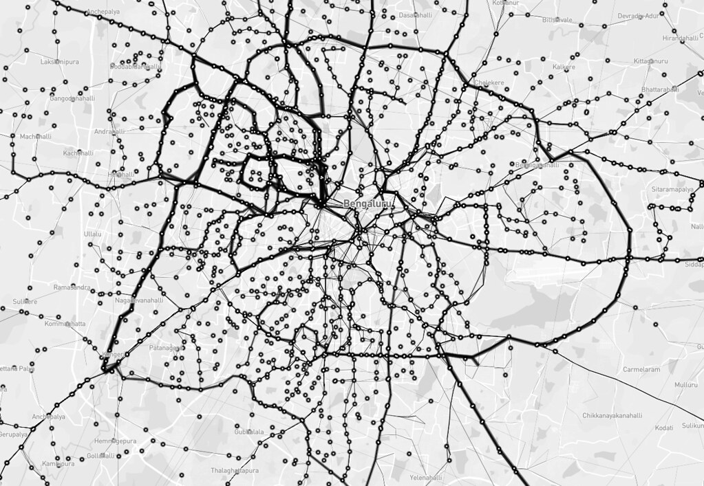
Next, I wanted to look at the frequency of different routes. In the image below, stroke thickness indicates how many trips each route makes. The relationship of the bus terminals with neighbourhoods and the road network can be easily observed. For instance, the north and west of the city have fewer, but more frequent routes. Whereas, the south has more routes with less frequency. Also, nodes in the north and west seem to rely more on the trunk roads than the diversely-connected nodes in the south. One can easily trace the Outer Ring Road, too.

View the map full screen.

Reachability

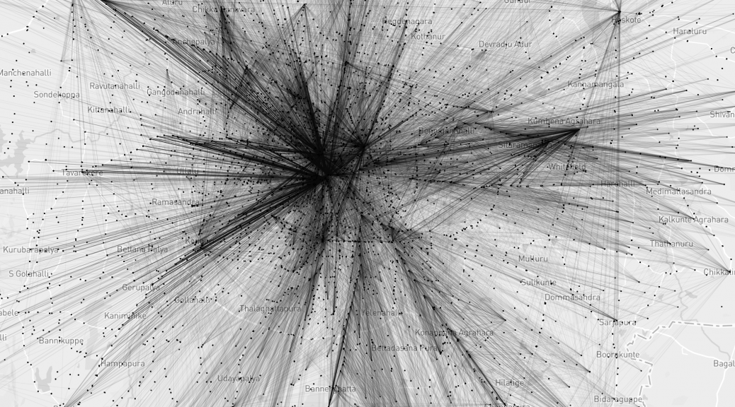
I tried to define reachability as destinations one can get to from a stop without transferring to another bus. The BMTC network operates long and direct routes. The map shows straight lines between bus stops that are connected by a single route. The furthest you can get is from Krishnarajendra Market (KR Market) to the eastward town of Biskuru: roughly 49 km as the crow flies.

View the map full screen.

Direction

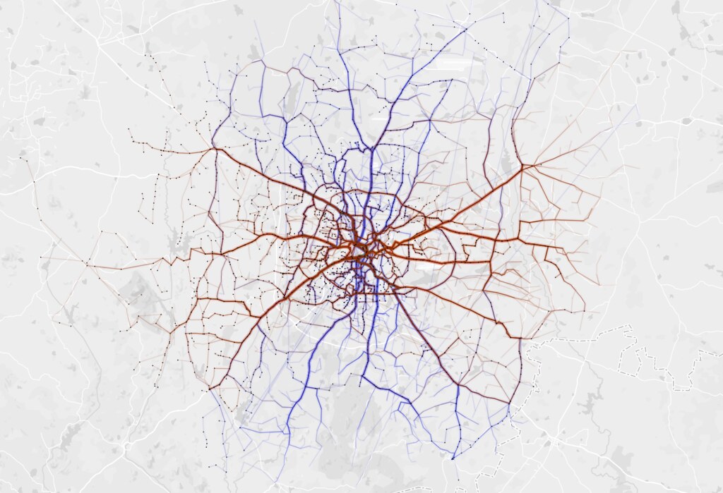
Which directions does BMTC run? It is interesting that BMTC covers the city North – South (blue) and East – West (brown) with almost equal distribution.

View the map full screen.

Coverage

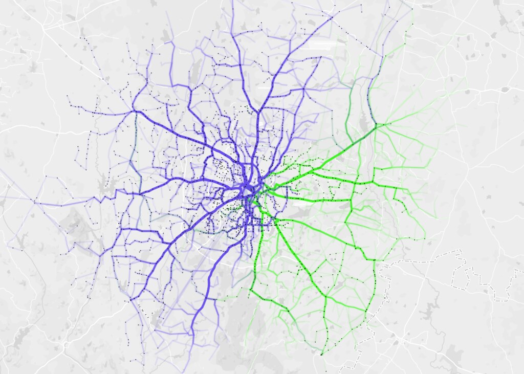
BMTC routes are classified into different series. Starting from 1 – 9 and A – W. I analysed coverage based on series 2 (blue) and 3 (green) and they make up almost 76% of the entire network.

View the map full screen.

Redundancy

Tejas and I took turns to try and figure out the redundancy within the network. Redundancy is good to absorb an over spill of bus commuters. Redundancy is a drain on resources and makes it hard to manage such a vast network with efficiency. So, we looked at segments that overlapped different bus routes.

View interactive map.

Node strength

This map by Aruna shows node strength – number of routes passing through a particular stop. You can see that the strength decreases as we move away from the city center with the exception of depots.

View interactive map.

Just like the data, our code and approach are open on Github. We would love to hear from you, and have conversations about the visualization, the BMTC, and everything in between!

OpenPostbox.org

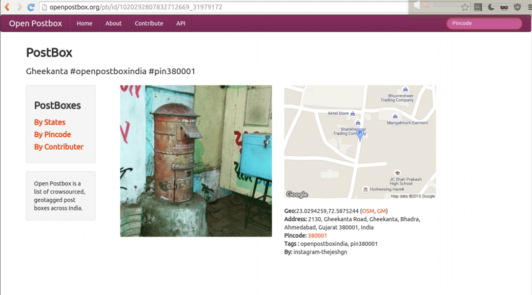
We got a chance to talk to members of Karnataka Philatelic Society about OpenPostBox. They are very interesting set of people. They have also started sending me the postbox pictures using WhatsApp along with location. Now I need to find an efficient way to extract them and insert into my database.

As of now I am thinking of Export -> Parse -> Insert. Working on it. If you have any ideas do email me.

dm_openpostbox

Details of the meet are on my personal blog if you like to read.

Global Open Data Index: Water Quality

Last year I helped assess the water quality section of the Global Open Data Index (GODI). Given the news of lead poisoning in Flint, Michigan and increasingly beyond, safe drinking water is no longer assured even in countries where it’s been guaranteed, so I am very glad they included it in GODI.

GODI is a survey of 122* countries that look at the status of ‘high priority datasets’ and whether they are truly open according to the Open Data Criteria. Water quality was included last year for the first time. So my job was to examine each country’s submission  and assess if the data submitted was what was asked for and met the criteria for being open. This was a daunting task but I figured if I could find water quality data in India of all places it wouldn’t be impossible.

Assessment Criteria/Methodology

GODI looked for very specific parameters:

While there are a lot more parameters that could be asked for, these were a good sample of parameters to assess if there is robust water monitoring in the country.

After the initial submission phase there were a lot questions about why wouldn’t the survey just ask for drinking water quality data or environmental monitoring data?

Choosing parameters instead of programmes is important because monitoring the environment and drinking water quality are connected. Some countries haven’t really established large nationalized water treatment strategies, drinking water comes directly from a natural resource so the environmental monitoring data inadvertently applies to the drinking water scenario.  Which means that if a country really has robust water quality data they must have these 5 parameters because they cover surface and ground water sources and also reflect safe drinking water standards.

The assessment would be rejected if a submitter only found the surface water body monitoring stations (environmental water monitoring) for instance because arsenic and fluoride are only found in groundwater. So the submitter would either ideally find the treated drinking water quality data which will cover all the parameters or the source water quality data for both surface and ground water.

For a full look at the methodology of the entire survey go here.

Some background

There is no one way to create water management systems but there are two major ways by which people get water – directly from the source or piped in from a source or a treatment facility. The origins of the water source is important. If you are getting water from the ground there are different quality issues  than from surface water (lake or river). If water is from a treatment plant there is a possibility that plant is getting water from both surface water, ground water, and in some cases recycled water. Usually water quality is measured at source and after treatment (treatment plants take multiple water quality samples during the treatment process.)

A full water quality assessment means lots of parameters and not all of them are tested the same way; some parameters take several days and require specific conditions, others can be taken easily through filters or litmus papers.  Water quality is a deliberate process of sampling and testing, and it not as easy as sticking a sensor into the water and monitor a continuous feed of data (although the potential for these approaches is quickly growing as technology improves.)

What I looked for

Since water quality was a scientific process I figured if I found any proof of water treatment or quality monitoring, a dataset would not be far off. After going through a few countries I noticed that the different water management approaches and policies affected where you would find the data.

Most countries give drinking water treatment responsibilities to local bodies but sometimes is monitored by central government under public health regulation so aggregated data could lie with the public health ministry or the environmental protection body.  In most cases responsibility for environmental monitoring fell to a central government Environmental Ministry.

So this scenario means that multiple datasets exist – a centralized dataset for surface and groundwater that  usually lies with the environmental ministry that could have all the parameters but sometimes doesn’t, or it doesn’t have real time data (this means data  may be available but from less frequent data collection such as quarterly or half yearly efforts). Or the Public Health Ministry has reports of water quality with all the parameters but these are aggregated, and usually in a report form (not a dataset) and not updated in a timely manner.

The US, for instance, falls under this group and can produce confusing submissions. The US has a robust geological survey of surface and ground water sources. However, the drinking water reports are supposed to go to the Environmental Protection Agency but no one seems to be updating the database with information. In my assessment I reduced the score because both are supposed to be available in the public domain.

There are countries like Belgium where water management and monitoring are completely left to the local body and there is no central role for monitoring at all, which meant there is no dataset.

There are countries where there is a strong central role in water management and a dataset could be made open like in France. Korea stood out, because they have live real time water quality information from their treatment plants that gets updated to a website.

Then there are the ‘unsures’: which are countries that seem to treat water to some degree or have national drinking water monitoring programmes but don’t have data online, reports or any mention of data at all. This is not restricted to the developing world. I was very frustrated with several European countries with newspaper articles riddled with reports of how pristine and delicious their water is that don’t have a single public facing dataset.

Take Aways

United Kingdom and the US, both pioneers of the open data movement had terrible water quality data for water treatment, and no effort has been made to bring the data together or make it available in a real time fashion.  Also it is not clear to citizens who holds local bodies accountable for not updating their reports, making reports public or finding ways to bring this data into the light so it can be usable. It is no wonder that the US is now on the cusp of a public health crisis.

It is frustrating that the open data movement hasn’t quite been able to reconcile decentralization and local responsibility with national level accountability and transparency. Public health is a national level issue even though local and regional contexts are required for management. How do we push for openness and transparency in systems like this?

In places like India where water quality treatment is largely left to private players and huge populations are not receiving treated water, the need for data to be available, open, and in the hands of central bodies but also local players is a must, because people need to try to find solutions and where to intervene. Given the huge problems with water borne diseases, the slow but epic arsenic and fluoride poisonings gripping parts of India, and the effects this will have for generations, making this data public, usable and demystified is no longer an option.

All in all, I have to say this was an enlightening experience, it was cool to be able to learn something about each country. In our continuous push for open data we sometimes get lost in standards, formats, and machine readability, but taking a moment to really prioritize our values in society and have open data reflect that is essential. Public health outcomes and engaging with complex issues like it are an essential part of how to grow the open data movement and make it relevant to millions more.

*(Correction: Previous version said the survey included 148 countries, the actual number is 122.)

Bihar Elections

DataMeet has always been interested in doing projects so last year we decided to run a pilot. In the last few years the demand for data work has increased from non profits and journalists and they usually approach data analytics vendors like Gramener. However, these firms can be expensive or have high paying clientele which means that smaller accounts tend to not get their full attention. This leads to an increase in volunteer events like hackathons which don’t always result in finished usable products or can give non profits the long term engagement they need to solve issues. Vendors are not usually privy to the specific data problems a sector has and don’t want to let their tech people invest the time to learn about the subject and understand the particular data challenges. Though the civic tech space is growing, non profits and media houses can’t yet afford or see the need for internal tech teams to deal with their data workload.

With all this in mind we wanted to see if DataMeet can help fill and enrich this space as well as help build capacity within non profits to manage data projects. We were trying to find out, can we assemble teams through the DataMeet network to manage the entire pipeline of data work from clean up to visualization. These wouldn’t be permanent teams but filled with freelancers or hobbyists.

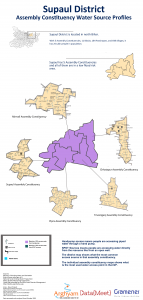
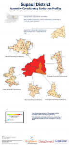
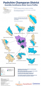
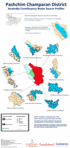
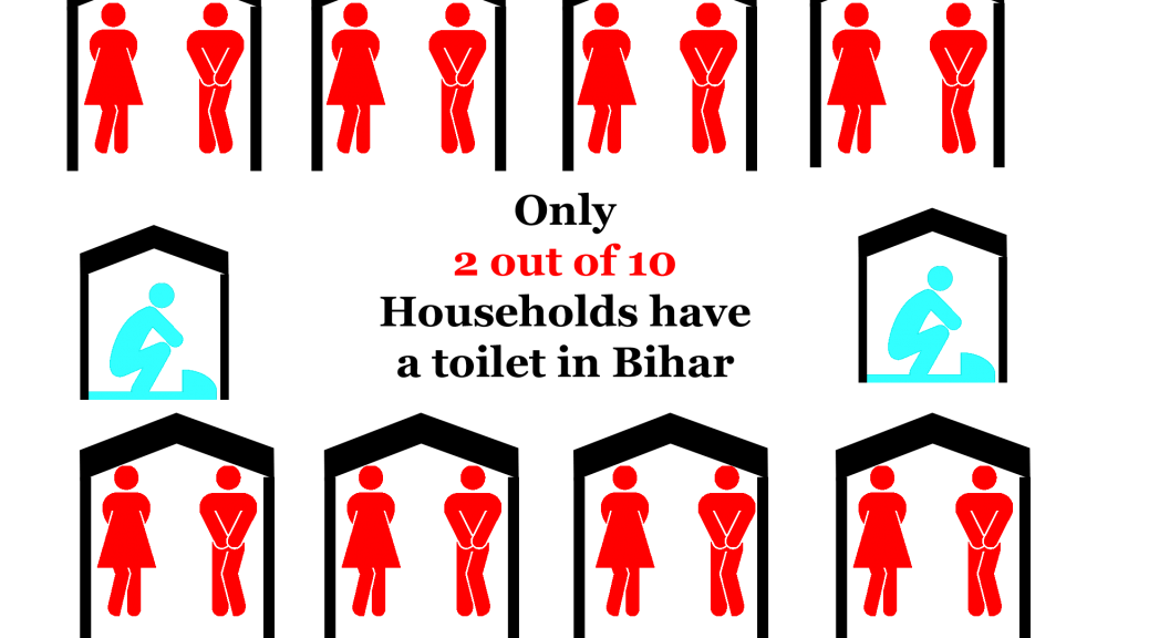
For this first project DataMeet would project manage and Gramener would provde the data analysts, the non profit managing partner was Arghyam and the ground partner was Megh Pyne Abhiyan. Megh Pyne Abhiyan works in several districts in north Bihar on water and sanitation issues. They wanted to use data to tell the story of what the status of water and sanitation was in those districts as a way of engaging with people during the election. It was decided we would do water and sanitation (WATSAN) status report cards for 5 districts — Khagaria, Pashchim Champaran, Madhubani, Saharasa, and Supaul — using government data.

This was an exciting project for us because it would be the first time DataMeet would work with a partner who works on the ground and the output would be for a rural, non online, non-English speaking audience.

DataMeet would project manage the process of data cleanup, analysis and visualization (which the team from Gramener would do) and then give the report cards to the Megh Pyne Abhiyan for them to do the translation and create the final representation of the report cards for their audience.

The Data

The partner wanted the data to be mapped to Assembly Constituencies, they wanted analysis for following situations

  1. Sanitation coverage for each Assembly Constituency and Gram Panchayat.
  2. Water quality, what is the contamination situation of the district, Assembly Constituency and Gram Panchayat.
  3. Water access, how do people get their drinking water.

It was also important to understand this data in the context of the flood prone areas of Bihar. For instance if there is an area that gets drinking water from shallow wells, with little sanitation in a high flood area those areas can suffer from high levels of water borne diseases.

The data we got was from

Since we were doing report cards based on Assembly Constituencies we needed the data to be at the Gram Panchayat (GP) level. Luckily the MDWS does a good job of collecting data all the way down to habitation so GP level data was available.

There is no official listing of what GPs are in which Assembly Constituency so the partner was asked to split the data by AC so we wouldn’t have to do that mapping. They agreed they knew the area better and would have the resources to pull together all the GP level data into organized Dropbox folders grouped by districts then split into ACs.

Data Cleanup

We received one PDF file per GP,  for water access and number of toilets, water quality was given in one large file by district.

All the data we received was in PDF. This was a huge hurdle as the data was from the government information management system so it was from a digital format but rendered in a PDF this meant that we had to convert unnecessarily. However, since the ground partner picked the data they needed and organized it by AC we wanted to make sure we were using the data they specified as important. So we decided to convert the data. This job was done by Thej and I and was extremely manual and time consuming and caused some delay in the data being sent to the analysts.  (See how we did it here.)

Analysis

The analysis required was basic. They needed to know at an AC level what the sanitation coverage was, the sources of water, how people were accessing it and what the water quality situation is.  Rankings compared to other districts and ACs were done to give context. Rankings compared to other districts and ACs were done to give context.So in all the analysis stage didn’t take much time.

Example of Analysis


Visualization

The UNDP along with the Bihar State Disaster Management Authority had created a map of diaster prone areas including flood. It was in PDF so we asked the folks at Mapbox India to help out with creating a shapefile for the flood map so we layer flood areas onto the Assembly Constituencies.

Bihar AC map with flood prone areas


While we had AC maps we didn’t have GP level maps. They didn’t seem to be available and we couldn’t find them in PDF form either.

Since the election is staggered by district we started with Khagaria. After the initial report cards were done the partner wanted just the cleaned up data in tables to use for their meetings. So we then decided to do the report cards, clean up the data and send the spreadsheets over to them.

As we were processing the next 4 districts I found GP level maps of Bihar, with boundaries of ACs included. This was quite exciting and I thought since we had some time we could do maps for the four pending districts.

After receiving the analysis for the next district I decided that since it would take to long to trace the PDF maps, so the analysts could map the GPs, I would just over lay them onto our AC shapefiles in Photoshop. I was going to put icons or circles in the center of the GP and that would be the map. While tedious I figured it would be worth it to show the maps to the ground partner.

However, when I started mapping I realized that analyzed data wasn’t matching up with the GPs on the map. The GPs listed in the Assembly Constituency in our original folders were incorrect, which meant all the analysis was wrong. Everything had to be checked against the maps and reorganized in the final datasets and then reanalyzed. This caused a huge delay.

On top of that the GPs on the map were spelled differently than in the MDWS data, and every dataset potentially had a different spelling of a particular GP. Which meant the remapping of the data had to be done manually looking at the map, the data, other sources, and sometimes guessing if this was the correct GP or not. This ended up being a manual process for every AC, as we didn’t do this mapping and standardization in the beginning.

While the delay caused problems with the maps being used in the election, they were worth doing to understand the problems with the data and the ground partner identified with the maps the most. By the end we were able to produced districts posters for the different parameters.

Sample report card


Final Posters

PC_sanitation copy poster madhubani_wateraccess copy poster madhubani_sourceprofileposters madhubani_sanitation poster Supaul_wateraccess copy poster copy Supaul_sourceprofile poster copy Supaul_sanitation copy poster copy Saharsa_wateraccess copy poster copy Saharsa_sourceprofile poster copy Saharsa_sanitation copy poster copy PC_wateraccess copy poster PC_sourceprofile poster


Lessons for next time

We learned a lot from this process. Mainly that the issues with standardization of Indian names in data is a real concern. While initiatives like Data.Gov.In are an important first step, it will take real will and dedication to work out this problem.

NGOs and groups that don’t work with data at the scale of modern data techniques are not always familiar with issues like formats, standardization problems, data interoperability,visualization and mapping to other datasets. This means that more time needs to be spent getting the intentions of the project out of the partner not just outputs. Problems like PDFs are not things everyone thinks about so the extra time of working with the partner to understand what data they want and find way to get it are better spent then converting PDFs to CSV if we don’t have to.

Designers are important, I created and designed the maps and posters, while I’m proud of them, they could have been done better and faster by a trained designer. Designers are worth the money and effort in order to make the final product really reflect the care and work we put into the data.

I consider this experience a success, despite the setbacks, we learned how to manage a team that was not full time and how important the initial work with the ground partners are to create realistic deliverables and timelines.

You can get all the data on DataMeet’s github page. 

Big thanks to the Gramener team – Santhosh, Pratap and Girish for dedicating their free time to this.

Five Years of DataMeet Discussions

We consider 26/01/2011 as DataMeet birthday. Thats the day we talked about starting DataMeet and hence it is the birthday. But the first email to the group was sent by S.Anand on 27/01/2011. Its been five years since that first email. I took this opportunity to scrape the email list to see how we are doing and what we talked about in last five years.

Growth

Activity

Members have started 1525 and have sent in total 4570 emails. But most important is how many participate.
infogram

Category Members
No Emails 855
1 Emails 184
2 Emails 75
3 Emails 43
More than 3 189

Discussions

Go have a look at full view of the traffic graph. Except for few peaks the group has been fairly consistent.

Starters

We have discussed about 1525 in last five years. Here is the list of top 20 starters.

author total topics started
Nisha Thompson 199
Thejesh GN 164
sumandro 71
Sridhar Gutam 64
srinivas kodali 36
Gautam John 30
Sajjad Anwar 28
Pranesh Prakash 27
bawaza…@gmail.com 27
Venkatraman.S. 23
satyaakam 22
S Anand 21
Balaji Subbaraman 20
Nikhil VJ 19
Justin Meyers 15
Sanky 15
Dilip Damle 14
Maya Indira Ganesh 13
Shree 13

First Responders

The first responders are important when someone posts a question. They are the first ones to respond to the questions. As you would have guessed the list is different from the starters list.

author number first response
Devdatta Tengshe 36
Gautam John 36
Nisha Thompson 57
srinivas kodali 28
Thejesh GN 27
Sajjad Anwar 21
satyaakam 20
Arun Ganesh 16
Avinash Celestine 15
Venkatraman.S. 15
Anand Chitipothu 14
sumandro 13
Dilip Damle 10
JohnsonC 10
S Anand 10
Gora Mohanty 9
Meera K 9
Sabarish Karunakar 9
Nikhil VJ 8

Part of many discussions

These are the members who have participated the most.

author total_emails_sent
Nisha Thompson 397
Thejesh GN 297
Gautam John 158
srinivas kodali 128
sumandro 109
Sajjad Anwar 93
Arun Ganesh 88
Dilip Damle 88
Devdatta Tengshe 85
satyaakam 83
Sridhar Gutam 81
Avinash Celestine 73
Justin Meyers 71
S Anand 68
Pranesh Prakash 67
Venkatraman.S. 64
Nikhil VJ 55
Raphael Susewind 55
Anand Chitipothu 51

Topics

We have discussed many many topics over years. But there are some popular topics. I have the list of topics by most replies.

Starter date/time topic
Karthik Shashidhar 2015-05-04 23:00:01 Shapefiles for "complete" India
megha 2014-04-10 14:10:21 MP/MLA Shapes
Srihari Srinivasan 2013-03-06 22:59:44 List of BMTC Bus stops
Nisha Thompson 2014-05-20 23:51:49 Logo Contest Voting!
S Anand 2016-02-01 18:31:38 PIN code geocoding
Siddarth Raman 2014-04-17 16:16:29 Parliamentary Constituency to Assembly Constituency to Ward linkages
Nisha 2013-04-15 09:44:21 April's Bangalore DataMeet
Gautam John 2012-04-14 09:49:50 I Change My City
Arun Ganesh 2011-03-14 11:23:25 Licensing crowdourced data projects
Sharad Lele 2015-11-27 19:59:49 Census of India seems to have maps of everything!

We also get quite a bit of traffic through search engines. So here is the list of top topics by views.

username date_time views topic
Karthik Shashidhar 2015-05-04 23:00:01 12324 Shapefiles for "complete" India
S Anand 2016-02-01 18:31:38 4783 PIN code geocoding
srinivas kodali 2013-07-01 12:49:33 2291 GeoJson data of Indian states
Aashish Gupta 2014-02-24 10:23:12 763 1981 and 1991 district-wise census data
Justin Meyers 2014-07-26 22:05:13 668 Updated Taluk Shapefile!!
indro ray 2013-08-13 10:21:18 651 MCD Delhi Admin Boundary GIS map
My profile photo 2012-08-30 17:41:45 615 Bangalore – BBMP ward boundaries – shape files available now
megha 2014-04-10 14:10:21 556 MP/MLA Shapes
Kavita Arora 2012-09-13 23:32:25 546 Ward Wise data for Bangalore – 2011 census?
Renaud Misslin 2014-12-03 09:45:16 426 Delhi ward shapefile for census 2011 data

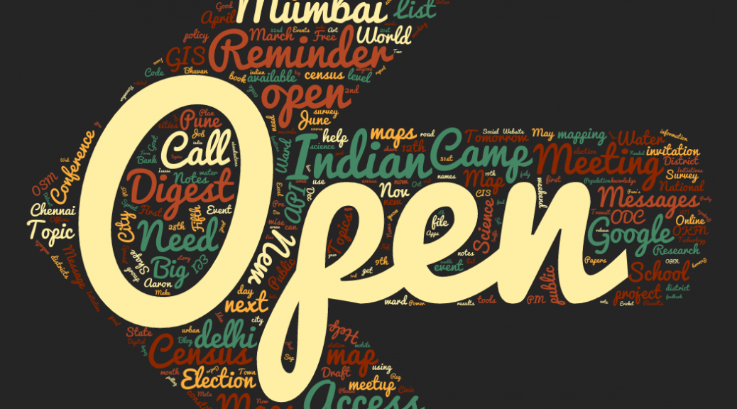
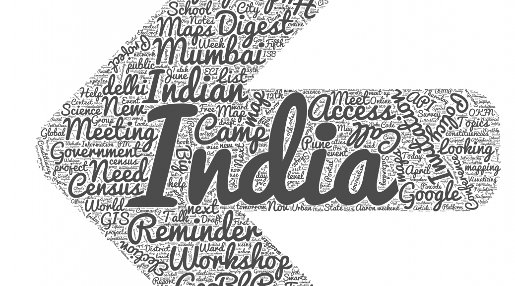
At last customary wordcloud of topics.

wordcloud_subjects_arrow2

Of course all the scrapers and data is available on github. Go ahead make your own visualizations.

DATA{MEET} PUNE, 5th Meetup – Roundtable

-article by Rasagy Sharma

On the 16th of January, we hosted the fifth Datameet event for the Pune chapter at the Symbiosis School of Economics. The focus in this event was more on enabling discussions and initiating collaboration, so a Roundtable format was selected with three main speakers: Padmaja Pore from Door Step School, Jinda Sandbhor from Manthan Adhyayan Kendra and Nikhil VJ (Centre for Environment Education).

The session started with everyone introducing themselves. After that, Craig — co-organizer of the Pune chapter — talked about what Datameet is, how it started, and the aim of city chapters. He then explained how the Pune chapter is focused on connecting data-enthusiasts from various disciplines — such as NGOs, Data Analysts, Engineers and Designers — to help collaborate and spread more awareness about how data can be used.

Every Child Counts – Education of migrant children

The roundtable started with Padmaja Pore introducing Door Step School, an NGO that runs several projects around primary education. One such project is Every Child Counts (ECC) that was started in 2011 and focused on ensuring that  every child goes to school at the right age of 6-7 yrs. Through ECC, Door Step School seeks to understand and address barriers  to the schooling of kids of migrant communities such as those engaged in nomadic professions,workers at construction sites, factories, brick-kilns, etc. in the vicinity of Pune city.  When parents move their home several times in a year itself, how can it be ensured that their kids remain enrolled in schools?

In India, there are more than 1 million kids out of school (18 million in Southern Asia and 69 million globally). The Right to Education Act has ensured that free and compulsory education is available, but no systematic process of finding and enrolling out-of-school not been actively implemented, with no definite count of the number of migrant children denied education. Surveys have been focused on children already working/street children, whereas the need is to focus on children who are 6-7 years old so that they are enrolled into schools before they get drawn into employment. There have been no active steps to put in processes at schools for ensuring migrant children can transition smoothly to another school when they migrate. .

The ECC Project has the following Implementation Methodology, which is volunteer driven

1. Surveys: Volunteers conduct surveys of construction sites in partnership with NGOs
2.Preparatory camps: Through the medium of preparatory camps, awareness is spread amongst parents of children on the importance of schooling. After working with the children, the team realized that these kids are not aware about the concept of formal education, and are not used to sitting at one place for a few hours to study. Thus the focus in the preparatory camps is on interactive activities to get kids more accustomed to the environment.
3.Admission/ Enrollment: The children and parents are accompanied to a local public school and assisted with the enrolment process. Parents are made aware of the provisions of the RTE act.
4.Support and Follow-up: Arranging transport to school wherever needed, tracking attendance and addressing reasons for non-attendance

The ECC project is currently running in Pune, Pimpri Chinchwad, Fringe areas of Pune & Nasik. The project uses various types of data:

  • Unified DISE data on schools, which is comprehensive but lacks spatial aspect
  • Crowdsourced spatial data of public schools
  • Spatial data of construction sites – Both crowdsourced and taken from real estate portals & builders websites
  • Spatial mapping of volunteers in the field
  • Children at each construction sites, spotted by volunteers and NGO staff

Data sources: http://schoolreportcards.in/SRC-New/ & http://www.dise.in

Currently the data is collected using a mobile app based on ODK (Open Data Kit) & KoboToolbox/ONA. The team is developing a Web based Platform for scaling the ECC Program pan-India and engaging NGOs and CSR groups in this cause. One of the key features of this Website is envisaged to be to engage volunteers actively with children to help motivate, enroll and track their continuity for larger impact.

Challenges

Padmaja then talked about the way forward and the challenges they were facing w.r.t developing the ECC Platform as well as actually reaching all children in the project areas.

  • No formal source available for school locations, hence data is still partially incomplete and dependent on crowdsourcing of school locations.
  • Need a systematic way to predict locations of existing and future construction sites to find migrant labourers.Set up an ERP like system to record a child’s details, so they can be tracked after migration as well
  • Create a mobile friendly website for the Platform
  • Create more interactive maps and chart visualizations, showing schools, sites etc (heatmap or other suitable format) for providing an aggegation/ disaggregation of data on migrant children. This can help in advocacy efforts.
  • Explore ways to track migrated children Find ways to dynamically update the databases and see changes in map/chart visualizations after a volunteer makes an entry on the mobile survey form.

After the talk, everyone pooled in with their ideas and suggestions such as connecting with Trekking communities to pair up as volunteers to reach out to any schools/kids on the outskirts of the city, and collaborating with initiatives like Sagar Mitra (Recycling plastic). Few problems were taken up by individual attendees for further discussions, like finding ways to automate the data entry into excel which is done manually right now. Interested attendees were requested to volunteer and also reach out to their community to spread the word.

Village level Mapping

IMG-20160120-WA0000

For the second talk, Jinda Sandbhor from Manthan Adhyayan Kendra spoke about village level mapping of tanker water supply in Maharashtra. With 14,708 drought affected villages in 2015 and 148 drought prone blocks, there is an immediate need for collecting data to analyze the reasons for drought and what can be done to better prepare for the future.

Most villages facing drinking water shortages due to lack of piped
water supply or lack of drinkable ground water. For such villages,
there is a tanker water supply from the Maharashtra government. The shortages are most severe just prior to and during the monsoon, some of these villages get return (North East) monsoons which reduces the demand of tankers by the end of the year. Jinda showed some aggregate data that has been collected that shows blockwise, the number of villages requesting the tanker supplies during
various months in the past few years.

There are multiple reasons for the demand of tankers:

  • Less rainfall & resulting drought is the main reason
  • Anthropogenic contamination of ground water
  • Dumping of mine water into the river

Challenges

Jinda highlighted his efforts to collect village specific data in some districts on the reason for request of the tanker. He mentioned that there is need for a village-level base map for Maharashtra that can help visualize and analyze this issue.
The discussions after this talk were focused on GIS related topics, with everyone agreeing for the need for detailed village level maps. While there are village level maps available in PDF as well as as a Web Map Service by Bhuvan, these need to be converted into shapefiles so they can be used for further analysis. This will enable visualizing with great accuracy, not just drought related data but any number of socio-economic parameters of Maharashtra for analysis.

It was also recommended to connect with Prof. Ashwini Chhatre from Indian School of Business (ISB) who has been working on Millets & Irrigation data and would have more detailed maps of the state. Another suggestion was to use GIS to take Land Revenue maps and convert into public-domain data.

Tools for participation in city governance

IMG-20160120-WA0001

The third talk was by Nikhil VJ who is the co-organizer of the Pune Datameet chapter and has been working on multiple data-centric projects. He also showed his work on cleaning and mapping Pune’s Budget sheet, which was originally available as a 600 page PDF and now has been converted to excel and cleaned up considerably. The Pune Municipal Corporation has now agreed to bring in some reform in its budget book format and Nikhil & CEE are working on possible ways to take such tasks forward. Nikhil also covered several tools and methods described below that are easy for anyone to pick up and can help solve some interesting data-related problems.
Some of the resources mentioned by Nikhil were:
The newly launched website www.sahbhag.in — Participatory Urban Governance in Pune
nikhilvj.cartodb.com — Maps & Datasets of Pune posted online by Nikhil
www.crowdcrafting.org — Collecting & mapping of data with the power of crowdsourcing
Localizing Pune’s budget data by Nikhil & other volunteers:
http://crowdcrafting.org/project/localpunebudget
Map form — An experimental method that Nikhil has craeted to collect location data using WordPress plugins
www.mapwarper.net — Using maps that are currently as an image to wrap on
an actual map

With this, the session was formally concluded.


Sikkim

#LATEPOST

Sikkim State Government passed an open data policy Sikkim Open Data Acquisition and Accessibility Policy in 2014. With pushing from the Chief Minister and Member of Parliament the Honorable Prem Das Rai they turned to open data to take control of the state’s data. The Honorable Mr PD Rai has repeatedly mentioned is the lack of access to government information on demand. It is not uncommon for lawmakers to ask questions only to have to wait a day or more for the answer and lose a moment to use that information for decision making.
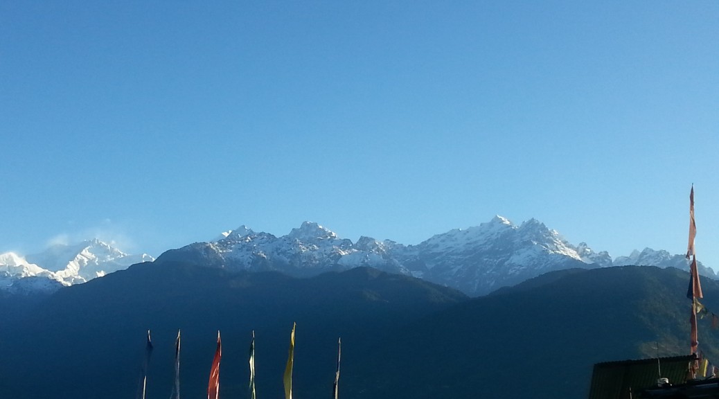
An Open Data for Human Development Workshop was organized by the International Centre for Human Development of UNDP India, with the Centre for Internet and Society, AKVO, Mapbox and DataMeet co-facilitating the event in Bangalore last June. The aim was to bring together members of the Sikkim government, IT professionals, and open data enthusiasts.

20150416_124455

In April before the workshop Sumandro (CIS) and I went to Sikkim to have a pre consultation with the Sikkim government on how to prepare for the large workshop in Bangalore. We met with the MP and the heads of the Rural Development, Health, and IT departments to discuss their plans to implement their open data policy. Then there was a large meeting with all the departments and the MP. We presented different things you can do when data is opened and offered suggestions for how to implement the policy. 20150416_123613The departments took turns discussing their issues regarding implementation; concerns like server space, technology needs, how to create incentives to accurate and timely data uploading were shared.

We presented things for them to think about in a preparation for the June event and for how to work with the open data community in India.

In June the workshop was held as NIAS. Thej gave a session on data tools that can be used to assemble, clean, analyze, publish and visualize data. Some of the tools that he introduced and used during the workshop are

  • Tabula Its difficult to extract data from PDFs. But Tabula allows you to extract that data into a CSV or Microsoft Excel spreadsheet using a simple, easy-to-use interface. Tabula works on Mac, Windows and Linux.
  • Open Refine – is a powerful tool for working with messy data: cleaning it; transforming it from one format into another; extending it with web services; and linking it to databases like Freebase.
  • DataWrapper allows you to create powerful charts very easily.
  • CartoDB is the Easiest Way to Map and Analyze Your Location Data

“Overall interaction was great. Delegates from Sikkim were very interested in DataMeet community and work we do as community. Some part of the workshop was used to introduce the community aspect of Data.”

You can see the full notes of the event at Centre for Internet and Society’s blog.

We are looking forward to see Sikkim be the first state to implement an open data portal using the Data.Gov.In platform.

To Hack or Not to Hack….

Hackathons are a source of confusion and frustration for us. DataMeet actively does not do them unless there is a very specific outcome the community wants like freeing a whole dataset or introducing open data to a new audience. We feel that they cause burn out, are not productive, and in general don’t help create a healthy community of civic tech and open data enthusiasts.

That is not to say we feel others shouldn’t do them, they are very good opportunities to spark discussion and introduce new audiences to problems in the social sector. DataKind and RHOK and numerous others host hackathons or variations of them regularly to stir the pot, bring new people into civic tech and they can be successful starts to long term connections and experiments. A lot of people in the DataMeet community participate and enjoy hackathons.

However, with great data access comes great responsibility. We always want to make sure that even if no output is achieved when a dataset is opened at least no harm should be done.

Last October an open data hackathon, Urban Hack, run by Hacker Earth, NASSCOM, XEROX, IBM and World Resource Institute India wanted to bring out open data and spark innovation in the transport and crime space by making datasets from Bangalore Metropolitan Transport Corporation (BMTC) and the Bangalore City Police available to work with. A DataMeet member (Srinivas Kodali) was participating, he is a huge transport data enthusiast and wanted to take a look at what is being made available.

In the morning shortly after it started I received a call from him that there is a dataset that was made available that seems to be violating privacy and data security. We contacted the organizers and they took it down, later we realized it was quite a sensitive dataset and a few hundred people had already downloaded it. We were also distressed that they had not clarified ownership of data, license of data, and had linked to sources like Open Bangalore  without specifying licensing, which violated the license.

The organizers were quite noted and had been involved with hackathons before so it was a little distressing to see these mistakes being made. We were concerned that the government partners (who had not participated in these types of events before) were also being exposed to poor practices. As smart cities initiatives take over the Indian urban space, we began to realize that this is a mistake that shouldn’t happen again.

Along with Centre for Internet and Society and Random Hacks of Kindness we sent the organizers, Bangalore City Police and BMTC a letter about the breach in protocol. We wanted to make sure everyone was aware of the issues and that measures were taken to not repeat these mistakes.

You can see the letter here:

We are very proud of the DataMeet community and Srinivas for bringing this violation to the attention of the organizers. As people who participate in hackathons and other data events it is imperative that privacy and security are kept in mind at all times. In a space like India where a lot of these concepts are new to institutions, like the Government, it is essential that we are always using opportunities not only to showcase the power of open data but also good practices for protecting privacy and ensuring security.