Category Archives: mapping

Survey of India Nakshe Portal

The Survey of India has launched a map sharing portal called Nakshe.  This is a great first step for the SOI who have not exactly been the most open with their maps.

“In Nakshe portal, user can see the list and meta data of all Open Series map(OSM) district wise released by Survey of India in compliance with National Map Policy – 2005. These maps are available for free download once the user login to the site using his/her Aadhar number. ”

While we applaud this initiative we hope they make it even better and more useful to a wider population. We have submitted to the SOI a letter with recommendations for the portal you can see the letter below.

We hope to get some feedback from people who have used the portal to get maps. We are happy to keep sending them feedback in hopes they will continue to improve the portal.

Happy Independence Day and Open Indian Village Boundaries

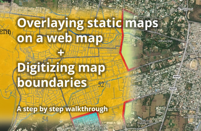
One of the longest and most passionately discussed subject on the Data{Meet} list is the availability of Indian Village Boundaries in Digital format. Search for Indian Village shape files and you can spend hours on reading interesting conversations.

Over last two years different members of community have tried to digitize the maps available through various government platforms or shared the maps through their organizations.

A look at the list discussion tells you that boundaries of at the least 75% of the states are available in various formats and quality. What we need at this point is a consolidate effort to bring them all on par in format, attributes and to some level quality. So some volunteers at Data{Meet} agreed to come together, clean up the available maps, add attributes, make them geojson and publish them on our GitHub repository called Indian Village Boundaries.

Of course this will be an on going effort but we would love to reach a baseline (all states) by year end. As of now I have cleaned up and uploaded Gujarat. I have at the least 4 more states to go live by month end. Karnataka, Kerala, Tamil Nadu and Goa. I will announce them on the list as they go live.

The boundaries are organized by state using state ISO code. All the village boundaries are available in geojson (WGS84, EPSG4326) format. The project page gives you the status of the data as we clean and upload. Data is not perfect yet, there could many errors both in data and boundaries. You can contribute by sending the pull requests. Please use the census names when correcting the attributes and geojson for shapes. Please source them to an official source when sending corrections.

Like everything else community creates. All map data will be available under Open Data Commons Open Database License (ODbL). This data is distributed in the hope that it will be useful, but WITHOUT ANY WARRANTY; without even the implied warranty of MERCHANTABILITY or FITNESS FOR A PARTICULAR PURPOSE. If you find issues we are more than happy to accept corrections but please source them to an official source.

On this 70th Independence day, as we celebrate the historic event of India becoming Free and Independent, Data{Meet} community celebrates by cleaning, formatting and digitizing our village boundaries. Have a great time using the maps and contributing back to society.

https://github.com/datameet/indian_village_boundaries

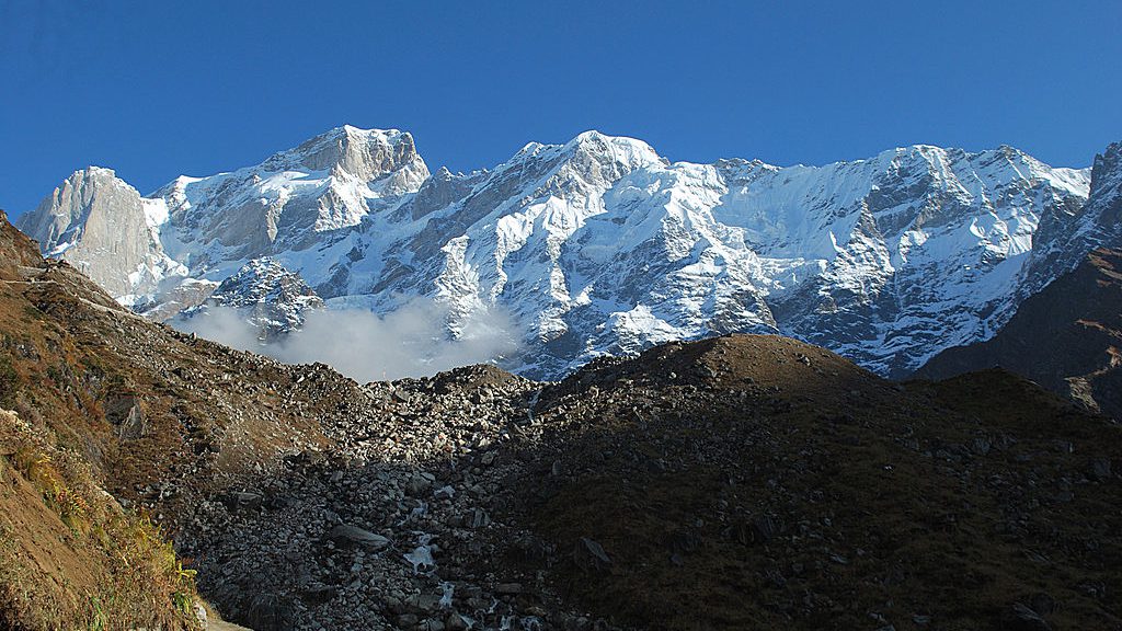
Picture: Kedarnath range behind the Kedarnath temple early morning. By Kaustabh, Available under CCBYSA.

Guide on Digitizing Static Maps

I was recently invited to Nagpur by a group called Center for Peoples Collective, to brainstorm doing for Nagpur the kind of things I’ve done in Pune for budget data processing/viz and mapping. We found that they didn’t have any digital data (ie, shapefile, kml etc) of Nagpur’s electoral wards, but they did have some high-res images released by Nagpur Municipal Corporation (NMC) with the boundaries marked. So I walked them through a process that I’ve worked out, which uses free online services and doesn’t need any software or advanced skills to do. I’m sharing that process here.
Continue reading Guide on Digitizing Static Maps

The first GeoDel meetup

On the 2nd of September, 2015, DataMeet-Delhi spun off a small side project known as GeoDel. Following GeoBLR‘s example, GeoDel is a Delhi-based group/community that meets to discuss open spatial data in the Indian context.

Akvo very kindly hosted us at their beautiful Delhi office, and we began with a very short talk by me (Shashank) on a quilt my mother made, based on OpenStreetMap data of South Delhi. Riju then spoke about mental maps, using a slideshow with some beautiful maps. He ended his talk with a participatory mapping exercise using FieldPaper maps of Delhi, where everyone who attended the meet had a chance to shout out a random place in Delhi, and everyone else had to mark it on their maps. It was a good way to learn about places in Delhi with arcane names such as ‘Rohini‘ and ‘Patparganj‘, and to end our first GeoDel as well.

GeoDel will have bi-monthly meets, so stay updated on its spatio-temporal coordinates via the MeetUp and FaceBook groups!