Category Archives: GIS

GPS and its Discontents

There is no greater success story for open data than GPS. The decision by the US government to make it available so it can be used for commercial purposes is the stuff of lore and what propels so much of the enthusiasm for open data.

Audiomatic’s show The Intersection is a podcast hosted by the dynamic duo Padmaparna Ghosh and Samanth Subramanian who explore interesting topics every other week.

Last week they did a show about GPS and it’s history and uses. Our own Thejesh GN was interviewed about his hobby of using GPS to go on treasure hunts.  They also talk about the Indian Government’s move to create a national GPS infrastructure with their own satellite so they don’t have to rely on the US.

I found the podcast informative and interesting and it hit on an important note as to why open data in India is so important.

Like GPS infrastructure to support India’s defense; data in India also needs to be invested in and promoted so that the reliance on others can reduce. Why is Google Maps, not Survey of India,  the source of mapping information in India? Why are their so many private data collection networks set up with foreign funds and private interests?Because GOI doesn’t invest in the potential of their data to build markets and make their job easier and more effective.

Open data is just one way of showcasing how better data can be used as well as offer guidance on how the government can invest in data collection and dissemination.

Anway it is a great podcast please give it a listen.
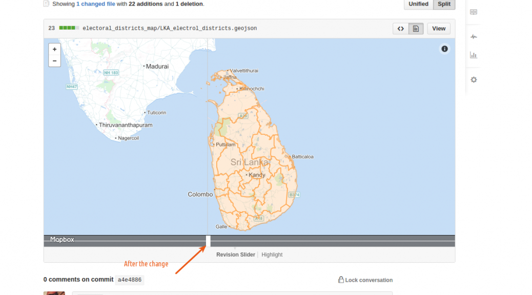
Map of Electoral districts of Sri Lanka

SriLankan maps for Electoral districts are available for download now. I initially made this for a friend who wanted to analyze the election results. The Electoral districts are derived from the administrative maps.

via GIPHY

You can check the diff on github to see how the maps were changed.

GADM database of Global Administrative Areas is the source of administrative data. I used three simple online tools

  • GeoJSON.io for converting from KML to GeoJSON and adding attributes.
  • MapShaper for merging the areas
  • GitHub for storing the map files.

Note: I don’t provide any guarantee on the accuracy of the maps. So don’t use if you want accurate maps. I have made notes on how these maps were derived. Use it if you think the process is right. Raise an issue if you find anything.

The first GeoDel meetup

On the 2nd of September, 2015, DataMeet-Delhi spun off a small side project known as GeoDel. Following GeoBLR‘s example, GeoDel is a Delhi-based group/community that meets to discuss open spatial data in the Indian context.

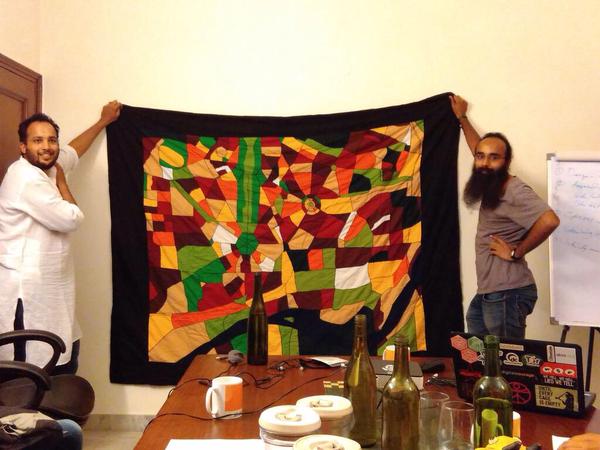
Akvo very kindly hosted us at their beautiful Delhi office, and we began with a very short talk by me (Shashank) on a quilt my mother made, based on OpenStreetMap data of South Delhi. Riju then spoke about mental maps, using a slideshow with some beautiful maps. He ended his talk with a participatory mapping exercise using FieldPaper maps of Delhi, where everyone who attended the meet had a chance to shout out a random place in Delhi, and everyone else had to mark it on their maps. It was a good way to learn about places in Delhi with arcane names such as ‘Rohini‘ and ‘Patparganj‘, and to end our first GeoDel as well.

GeoDel will have bi-monthly meets, so stay updated on its spatio-temporal coordinates via the MeetUp and FaceBook groups!