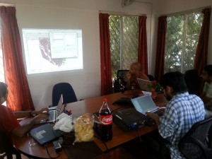
In preparation for Bangalore Open Data Camp 2014: Election special. We did two small workshops one on working with PDFs and the other on learning Georeferencing and Vectorising basics. We did these two workshops because so much of working with election data is parsing PDFs and trying to get shapefiles.
Indian MP/MLA Constituency shapes are created and maintained by the Election Commission. There is a great wealth of information on this site, and if you can go to the state sites to see even more local electoral information for Parliament and Assembly constituencies. However, these maps they give you are in PDF, if you want to create visualizations, layer data, or get any in depth understanding of your constituency these PDF maps make it difficult.
Sajjad Anwar headed our Georeferencing 101 workshop. He went through the basics of using QGIS the open source GIS software.
QGIS is a great free open source resource for creating, visualising and, editing spatial data of various formats. Like any editor you have to become accustomed to the layout and the terminology which can be hard for beginners. It might be overwhelming when you first start but just take a deep breath. There is a great intro guide here and tons of Youtube guides.
To start looking at georeferencing data:
Things you need:
- Download qgis 2.0 or above.
- Need a picture, any format jpg, png etc.
- Base Reference file preferably a vector file.
If you can’t determine the border needs enhancing clean it up with GIMP, Inscape or any of your favourite graphic editor, and use the Georeferencer plugin – set the ground control points
Where you can get some reference files
- Global administrative boundary website
- Open street maps –not the best but available
If you can’t find the reference file you might need. The best you can get is the taluk level, if you can get that you can reference constituencies but district level is also acceptable it is the easiest boundary you can reference. Don’t use Google it is a violation of their terms of service
When you have your picture and reference vector file you can then use QGIS to outline the picture by creating points. You put a point on the picture then pick the corresponding point on the map.
This assigns lat/longs to your picture and creates the references for the polygon to be created. After this then you can add layers of data and create your map visualization!
Any georeferencing you do is a derivative work, so just keep in mind the license of the base layer.
You can learn more about the challenges of creating MP/MLA constituency maps on the DataMeet Google Group here.
We will be doing more of these workshops in the future so check back here for more information.
